BreakingInternational
Arunachal’s Name Game: India Turns China’s Cartographic Weapon Back on Beijing
New Delhi’s calculated assertion of sovereignty unnerves Dragon
12 Aug 2026, 10:26 am IST·4 min read
China may have woken up to discover that a weapon it has used repeatedly against India can cut both ways.
New Delhi’s decision to formally standardise the names of 27 geographical features in Arunachal Pradesh on the Survey of India’s official map is far more than a cartographic exercise.
It is a calculated assertion of sovereignty—and, significantly, a response in kind to Beijing’s wearisome and monotonous attempt to manufacture territorial legitimacy through renaming of places.
Significantly, among the 27 locations formally identified on India’s official map is Longju, situated along the Line of Actual Control (LAC). The area became one of the earliest flashpoints of conflict between India and China after Chinese troops entered there in 1959. New Delhi maintains that the village lies within Indian territory.
China has reacted angrily, calling India’s move “illegal, null and void” and reiterating its claim over Arunachal Pradesh, which Beijing refers to as Zangnan or Greater Tibet. India, however, has shown little appetite for diplomatic niceties.
Reacting to India’s latest naming exercise, Chinese Foreign Ministry spokesperson Guo Jiakun said that China does not recognise the so-called “Arunachal Pradesh”, which he claimed had been “illegally established” by India.
He described India’s move to introduce “standardised names” as “illegal and invalid”. Reiterating Beijing’s territorial claim, he asserted that Zangnan is part of China—a claim that India has repeatedly and categorically rejected.
MEA Snubs Chinese Contention
“Arunachal is an integral part of India,” Ministry of External Affairs (MEA) spokesperson Randhir Jaiswal’s message is quite unequivocal. This is a “self-evident fact” which nothing can alter. The official Indian map, he added, is intended to give the locations their proper recognition and create greater public awareness about them.
New Delhi has now effectively entered Beijing’s cartographic battlefield.
By placing Longju unambiguously on its official map, India is doing something more consequential than merely changing labels: it is embedding its territorial claim into the country’s formal cartographic record.
China’s objection, therefore, was almost inevitable.
The timing is important. But the difference is that New Delhi possesses something Beijing cannot simply rename away: actual administration of Arunachal Pradesh.
China itself has repeatedly attempted to redraw the political geography of Arunachal through nomenclature. Beijing has periodically issued lists of Chinese names for places in the Indian state, the latest major exercise involving 27 locations in 2025. India dismissed those names as fictitious and rejected the underlying territorial claim.

Unconfirmed Reports of Chinese Incursions
But the more interesting question is what happens when the battle over names meets the battle over ground.
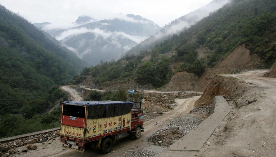
Reports from Taksing in Upper Subansiri district have alleged Chinese military intrusions across the LAC near Pukar La and Ollo. Chief Minister Pema Khandu initially expressed scepticism, saying the Army was effectively guarding the frontier and that he would seek clarity from the military and local organisations.
For New Delhi, this is precisely where the Arunachal question becomes strategically delicate.
At the 36th Working Mechanism for Consultation and Coordination (WMCC) meeting on August 6, India and China reviewed the situation along the LAC and again underlined the importance of maintaining peace and tranquillity along the frontier.
India also made it clear that the condition of the border will have a direct bearing on the broader state of bilateral relations.
Many believe that formally incorporating these locations into India’s official map just ahead of the BRICS Summit is a carefully calculated move: Delhi appears determined to use China’s own cartographic weapon against China, keeping Beijing under diplomatic pressure over its territorial claims in Arunachal Pradesh.
That formulation deserves attention.
It effectively links the two tracks of the relationship: diplomacy in the conference room and behaviour on the Himalayan frontier. India is telling Beijing that normalisation cannot be compartmentalised.
Claim of People’s Party of Arunachal
Meanwhile, a four-member fact-finding committee of the People's Party of Arunachal has now described the reported PLA intrusions in the Taksing area as “inexplicable yet irrefutable”. That does not amount to an official confirmation of a Chinese territorial incursion, but it makes the allegations considerably harder to dismiss as mere rumour.
The reported Taksing developments add an uncomfortable physical dimension to that message. Maps can assert sovereignty; troops, roads, surveillance and administration determine how sovereignty is experienced on the ground.
That is why the latest episode should not be viewed merely as another India-China war of words.
It is a contest over who gets to define reality—on maps, at diplomatic tables and eventually along the LAC itself.
And New Delhi’s latest response suggests that, at least on Arunachal Pradesh, it has decided that Beijing will no longer be allowed to write the map unchallenged.
About the Authors

Prasanta Paul served Deccan Herald as the Chief of Bureau, Calcutta for nearly two decades before switching to work with various TV channels such as Al-Jazeera, CNN, German TV and CBS. He also headed the Eastern Bureau of Parliamentarian magazine. Mr. Paul who accompanied former Prime Minister Atal Behari Vajpayee on his overseas tour of Singapore and other Asian countries, travelled extensively to Bhutan, Sikkim and Darjeeling besides other Northeastern states. He briefly headed the Mizoram Bureau of the United News of India (UNI).
Discussion
Reader Comments
No comments yet. Be the first to share your perspective.