BreakingEnvironment
Climate Change Remaking the Himalayan Rivers
Global warming is dramatically reshaping the rivers of the Himalayan highlands
26 May 2026, 08:22 pm IST·4 min read
Global warming is dramatically reshaping the rivers of the Himalayan highlands — bending, shifting and destabilizing waterways at a pace that has alarmed scientists, according to a major new study.
The research, led by Chinese scientists as part of the country's second comprehensive expedition to the Qinghai-Xizang Plateau, was published in May 2026 in the journal Science.
The Himalayas do more than tower over Asia. And the study offers some of the most detailed evidence yet of how climate change is transforming one of Earth's most ecologically sensitive regions.
Using satellite images and field observations from 1980 to 2020, the study categorically reveals the frozen water system is becoming less stable as the climate warms.
The Qinghai-Xizang Plateau of the Himalayas— often called Asia's "water tower" — is the birthplace of many of the continent's great rivers. What happens to those rivers during decades of global warming matters enormously; because nearly two billion people downstream depend on them for water security, agriculture and survival.
Professor Chengshan Wang and Dr. Zhongpeng Han of the China University of Geosciences, Beijing, worked with Dr. Lin Zhipeng of Sichuan University to investigate how these changes are affecting three major Himalayan river basins.
The First Such Large-Scale Study
To understand how those rivers are dramatically changing their courses, researchers analyzed 1,582 kms of river channels, more than 1,000 river bends and nearly one million individual migration events using satellite imagery and decades of field data — the first such large-scale study of its kind.
The results were stark and grim.
Between 2000 and 2020, the rate at which river bends shifted laterally nearly doubled compared to the preceding two decades. The frequency of rivers breaking through their banks rose by 77%, while sudden channel cutoff events surged by 115%. Rivers also switched more frequently between single and multi-channel forms — up 97%. Taken together, an index measuring overall river activity more than doubled over the 40-year study period.
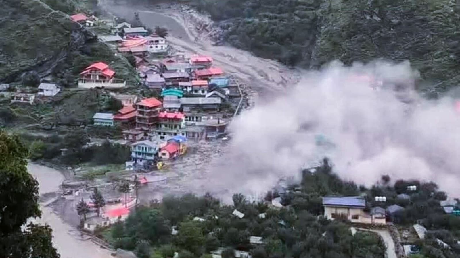
Some of the major disasters that have reshaped the Himalayan plateau in the affected regions, are mentioned below:
# The 2025 Tibet Earthquake: A massive 7.1 magnitude earthquake struck Dingri County, Shigatse Prefecture, very close to the Mount Everest base camp. The tremors were felt across Tibet, causing widespread destruction, toppling homes in remote villages, and resulting in over 100 deaths.
# Purepu Glacier Flood (2025): A transboundary GLOF originating from the Purepu Glacier in Tibet triggered severe flash floods along the Lende River, sweeping away major bridges, devastating inland container ports, and incapacitating hydropower plants.
# The Chamoli / Dhauliganga Flash Flood (2021): A massive avalanche of glacial ice and rock surged down the Dhauliganga river valley in Uttarakhand. It swept away multiple hydroelectric projects and killed over 200 people.
# The Kedarnath Disaster (2013): Unprecedented early monsoon rains and cloudbursts over the Chorabari glacier caused flash floods and massive mudslides in Uttarakhand. The deluge swallowed apartment blocks, washed away roads, and killed over 500 people, with nearly 6,000 going missing.
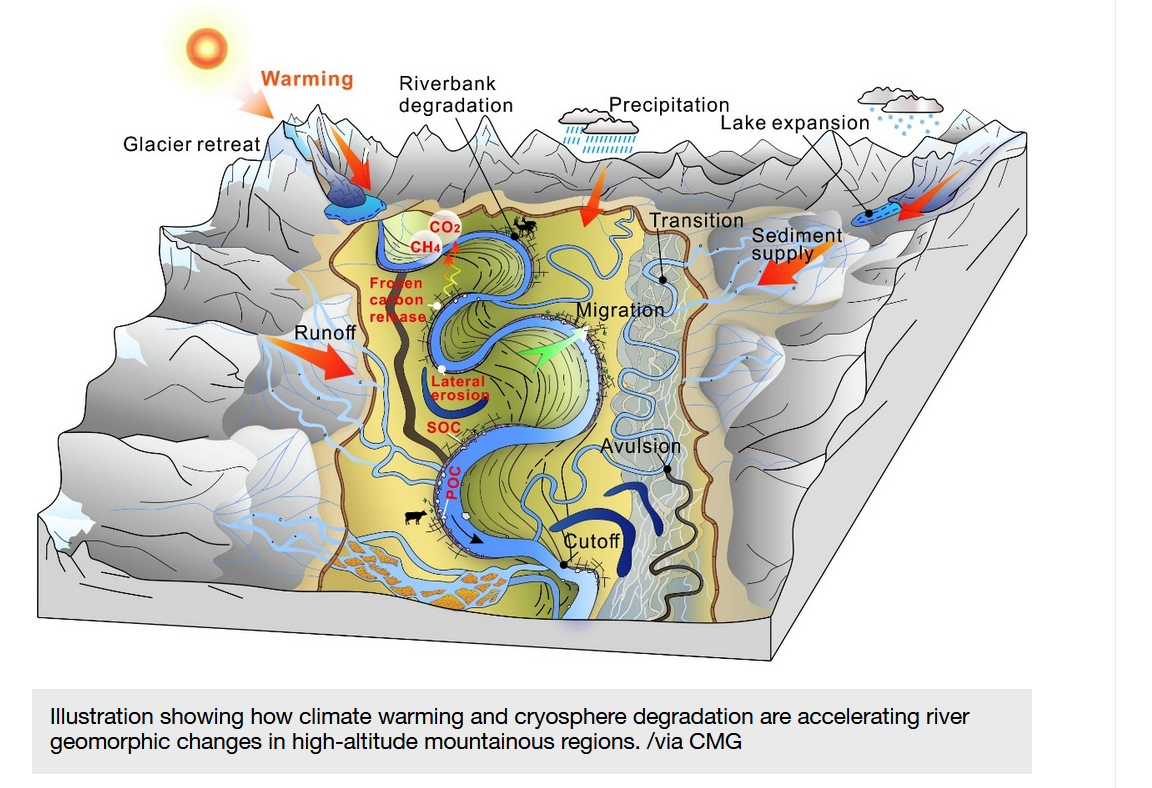
The culprit, researchers say, is the accelerating breakdown of the region's frozen landscape. Temperatures across the Himalayas are rising at roughly twice the global average, driving glacier retreat, permafrost thaw and the loss of seasonally frozen ground.
As glaciers melt, rivers carry more water and sediment. As permafrost softens, riverbanks lose their structural integrity. The result is a kind of cascade — rivers that were once relatively stable are now constantly rewriting their own courses.
River Bends Matter
The team used satellite imagery and field observations to study 1,079 river bends along about 1,582 km (983 miles) of river channels flowing through frozen ground. Many of these bends could shift freely because nearby landforms did not restrict them.
“The upper high Himalayas stand out as a region where climate warming and channel migration interact strongly, providing an opportunity to study the effects of a warming climate on river dynamics such as river meandering and planform morphodynamics,” says Dr. Han.
The Himalayan rivers' sensitivity to temperature is particularly striking. Compared with nearly 800,000 river bends studied worldwide, those in the Himalayas respond to temperature change at roughly eight times the global average — making them, in the researchers' words, ideal "sentinel sites" for tracking the planetary fingerprint of climate change.
The Grim Effect
That sensitivity also carries real-world consequences. More unstable rivers mean greater flood risk, disrupted ecosystems and growing uncertainty over water supplies for billions of people across South and Southeast Asia.
The researchers warn that faster river movement could affect water security, flood hazards, sediment-related risks, and infrastructure built along riverbanks. “For the billions who rely on Himalayan water sources, the acceleration of river dynamics documented in our study poses implications for water security, sediment-related hazards, and the stability of riparian infrastructure,” says Prof. Wang.
Hence, the findings, researchers caution, should inform flood prevention strategies, conservation planning and climate adaptation efforts — not just on the Qinghai-Xizang Plateau, but in glaciated mountain regions around the world.
Key Words: Climate Change – China University of Geosciences-Himalayas – Morphodynamics- River Bends - South and Southeast Asia - "Sentinel Sites"- the Qinghai-Xizang Plateau.
About the Author

Prasanta Paul served Deccan Herald as the Chief of Bureau, Calcutta for nearly two decades before switching to work with various TV channels such as Al-Jazeera, CNN, German TV and CBS. He also headed the Eastern Bureau of Parliamentarian magazine. Mr. Paul who accompanied former Prime Minister Atal Behari Vajpayee on his overseas tour of Singapore and other Asian countries, travelled extensively to Bhutan, Sikkim and Darjeeling besides other Northeastern states. He briefly headed the Mizoram Bureau of the United News of India (UNI). To his credit goes a deep-rooted empathy for social issues and marginalized people. His extensive coverage on the Tsunami, the Super Cyclone in Odisha and the 2020 Amphan cyclone besides the Gaisal Train mishap in eastern India has easily been the best around the world.
Discussion
Reader Comments
No comments yet. Be the first to share your perspective.