BreakingNational
New Strategy for ‘Chicken’s Neck’ to Reinforce Northeastern Gateway
Gadkari unveils a Faster Shield: High-Speed 6 lane Corridor
02 Oct 2026, 09:19 am IST·3 min read
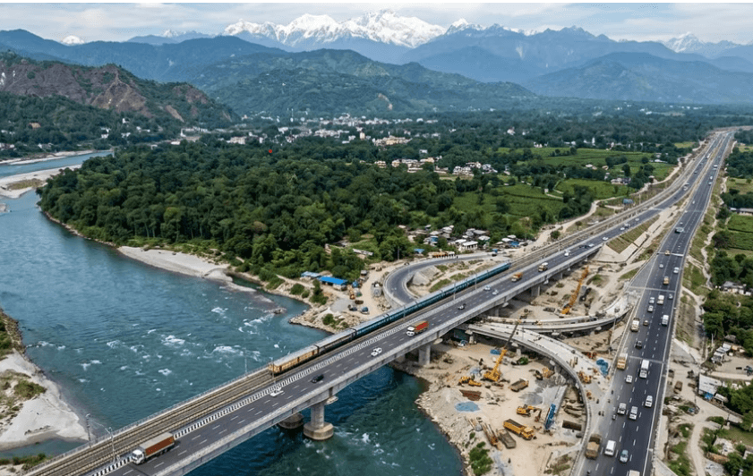
The Chicken’s Neck, the country’s most vital and vulnerable strategic chokepoint serving as the sole land bridge connecting mainland India to its eight northeastern states, is poised to receive a crucial boost.
As part of a reinforced security architecture featuring enhanced military and paramilitary positioning, a Rs 61,500 crore high-speed corridor connecting Siliguri-Guwahati-Shillong over a 630-km stretch has been proposed to be built by the union government.
Disclosing this, Union Surface Transport & Highways minister Nitin Gadkari said the proposed stretch, work of which is scheduled to start from November next, would be built in two phases.
The first phase will cover a 400-km stage connecting Siliguri with Guwahati and in the second stage, this corridor will be expanded till Shillong where a heavy concentration of Indian Army battalions already exists.
This crucial need for this heightened security infrastructure stems from the fact that the ‘Neck’ lies dangerously close to China’s strategically sensitive Chumbi Valley (highlighted during standoffs like Doklam), making it susceptible to a pincer movement or military blockade that could completely sever the Northeast from the rest of the country.
Plus, the ‘Neck’ is tightly sandwiched between Nepal to the west and Bangladesh to the south, with Bhutan and China sitting closely to the north.
Emergency troop movements across critical nodes like Dhubri (Assam), Kishanganj (Bihar), and Chopra (West Bengal) has become essential to fast-track heavy border fencing, advanced surveillance grids, and logistical depots.
A Second Coronation Bridge
In parallel, the Centre has sanctioned ₹1,175.59 crore for an alternative to the historic Coronation Bridge at Sevok over the Teesta. The new alternative, Gadkari said, would be a six-lane bridge, providing a modern replacement for a structure that has become increasingly inadequate for present-day traffic demands.
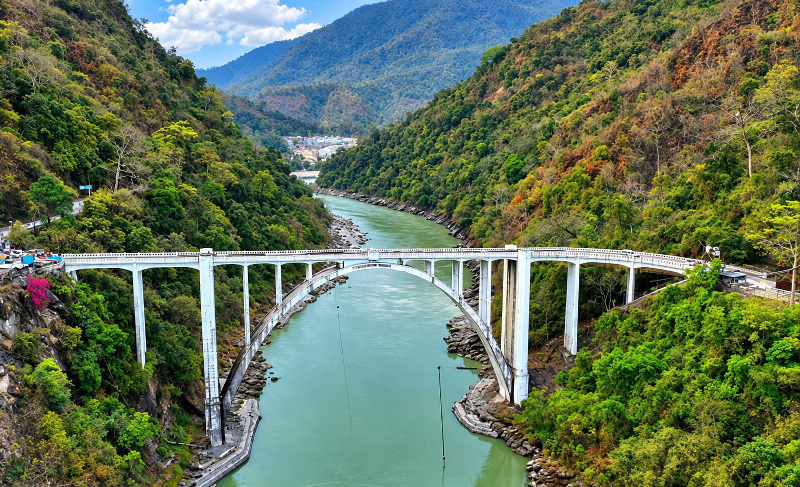
The Coronation Bridge over the Teesta at Sevoke
The proposed bridge will be 6.91 km long and is expected to substantially strengthen connectivity between the Siliguri Corridor, Sikkim and the wider Northeast.
According to Gadkari, the second phase will reduce the distance of the concerned route from around 100 km to 66 km. The reduction of roughly one-third in road length is expected to cut travel time by about one and a half hours—turning what currently takes around two-and-a-half hours into a journey of approximately one hour.
The third component pushes this transformation deeper into the Northeast.
Gadkari said a 165-km greenfield corridor between Shillong and Silchar is expected to receive the work order in November. The project will reduce the existing road distance from around 230 km to 165 km, while cutting the journey time from approximately eight hours to four.
Taken together, the three initiatives point towards a larger infrastructure architecture: a faster axis from Siliguri through Guwahati to Shillong, complemented by upgraded links towards Sikkim and further into the Northeast.
Strategic Significance of the New Corridor
The significance of the announcement goes well beyond highways; it carries an unmistakable strategic dimension for national security, particularly in ensuring rapid movement of people, goods and security forces.
In a region where terrain, narrow connectivity and weather can complicate transportation, reducing travel time can add an important layer of resilience to the country’s strategic infrastructure.
That is not merely a matter of commuter convenience. In strategic terms, every reduction in transit time across a difficult geographical zone increases the flexibility of the entire connectivity network.
Secondly, to bypass absolute reliance on surface routes through the narrow neck, India has been executing deep infrastructure upgrades—such as planned underground railway tracks between Tin Mile Haat and Rangapani at a depth of 20–24 meters—to maintain defense logistics during extreme conflict.
India's Northeast has long been described through the language of distance and difficult terrain. The new road strategy seeks to change that equation through speed, redundancy and capacity.
Hence, the proposed six-lane bridge therefore represents more than the replacement of an old structure—it is an attempt to create additional capacity at a crucial gateway.
About the Author

Prasanta Paul served Deccan Herald as the Chief of Bureau, Calcutta for nearly two decades before switching to work with various TV channels such as Al-Jazeera, CNN, German TV and CBS. He also headed the Eastern Bureau of Parliamentarian magazine. Mr. Paul who accompanied former Prime Minister Atal Behari Vajpayee on his overseas tour of Singapore and other Asian countries, travelled extensively to Bhutan, Sikkim and Darjeeling besides other Northeastern states. He briefly headed the Mizoram Bureau of the United News of India (UNI).
Discussion
Reader Comments
No comments yet. Be the first to share your perspective.